
|
|
|
| |
|
|
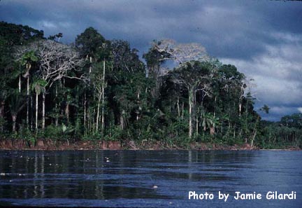
Pacaya-Samiria National Reserve is located in Peru's Amazon region, 93 miles from Iquitos. The Reserve is a triangular shaped area between the Maranon and Ucayali rivers. These rivers intersect at the northeastern tip of the Reserve, marking the beginning of what is considered the Amazon proper. The basins of the Pacaya and Samiria rivers have been protected by the Peruvian government since 1940. The area was declared a National Reserve in 1972 and enlarged to its present size of 5,137,000 acres in 1982. The Reserve is the largest in Peru, the second largest in the Amazon region, and the fourth largest in all of South America. (Do you know what the first three largest reserves are?) The great size of the Reserve assures that it will be ecologically and genetically representative of the region, with an abundance of virtually unchanged areas.
Objectives The objectives of the Pacaya-Samiria National Reserve are:
Of these objectives, the main objective is the conservation and protection of the flora and fauna found there. Unique to the Reserve however, is the objective to continue to use the natural resources found in the Reserve for the benefit of the people living in the area. Landscape & Elevation There are two types of landscapes found in the reserve. They are the *alluvial plain and the gently undulating hills found in the western part of the Reserve. The altitude of the Reserve is between 263 to 675 feet above sea level. (How does that compare with where you live?) The vegetation is very typical of what is found in humid tropical rainforests and is characterized by great *heterogeneity and *diversity of species. Rivers & Lakes
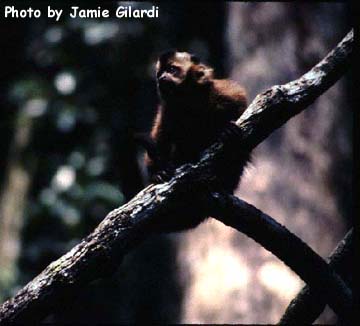
There are over 80 lakes in the Reserve, the most important ones are the Hatun Cocha, Pastococha, Shinguito, Maldonado, Ungurahui, Yanayacu, Zapote, Yarina, Tamara, Cotococha, Achual, and El Dorado. Animal & Plant Life
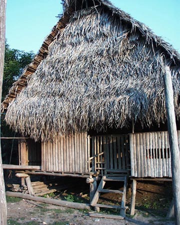
The People
To learn more about the Reserve, visit the Nature Conservancy in Peru.
|


